Ontario is home to one of Canada's largest and most diverse forestry industries. With over 70 million hectares of forested land -- the vast majority of which is Crown land managed through Sustainable Forest Licences (SFLs) -- Ontario's forestry software needs are unique and demanding. From the dense boreal forests north of Hearst and Kapuskasing to the mixed-wood stands of the Algoma and Nipissing districts, operators face challenges that require purpose-built digital solutions. This guide explores how forest management software Ontario operators rely on is transforming the way companies handle GPS tracking, fleet management, crew coordination and regulatory compliance.
Ontario's forestry landscape: scale and complexity
Ontario's forest sector generates billions of dollars in economic activity and supports communities across the province's northern regions. The industry operates primarily on Crown land, where SFL holders are responsible for forest management planning, harvesting operations and regeneration obligations under the oversight of the Ministry of Natural Resources and Forestry (MNRF). This regulatory framework creates specific data collection and reporting requirements that generic business software simply cannot address.
The sheer scale of Ontario operations sets them apart. A single SFL management unit can span tens of thousands of square kilometres, with active harvesting blocks scattered across remote territory accessible only by a network of forest access roads. Contractors working under these licences must coordinate multiple crews, manage heavy equipment fleets and deliver precise data back to SFL holders and the MNRF, often from locations with zero cellular connectivity.
Challenges specific to Ontario forestry operations
Vast distances and remote operations
Ontario's forestry territory stretches from the Manitoba border to the Quebec border, covering an immense area of boreal forest. Crews may be working hundreds of kilometres from the nearest town, and supervisors cannot physically visit every active block on a daily basis. Logging software Ontario operators need must bridge this distance gap, providing real-time visibility into what is happening at every job site without requiring a physical presence.
Managing multiple crews across vast territory
Large Ontario forestry operations often run five to fifteen crews simultaneously, each with their own equipment, production targets and operating areas. Coordinating these crews without a centralized digital system leads to information delays, miscommunication and scheduling conflicts. When a crew finishes a block early or encounters unexpected conditions, the office needs to know immediately to reassign resources efficiently.
Harsh winter operating conditions
Ontario's northern forests experience some of the harshest winter conditions in Canada, with temperatures regularly dropping below -30 degrees Celsius and staying there for weeks. Winter harvesting is critical -- frozen ground provides access to areas that are inaccessible during other seasons -- but the extreme cold pushes equipment and technology to their limits. Any forestry software Ontario companies depend on must function flawlessly in these conditions, running on rugged tablets that perform reliably in deep freeze.
MNRF compliance and forest management planning
Ontario's Forest Management Planning (FMP) process requires detailed documentation of harvesting activities, road construction, water crossing installations and regeneration efforts. Compliance with the Crown Forest Sustainability Act and associated regulations demands accurate, timely data that can be audited by the MNRF. Manual reporting processes are not only slow but prone to the kinds of errors that trigger compliance issues and potential penalties.
How ForestLogix and MobileLogix solve Ontario's challenges
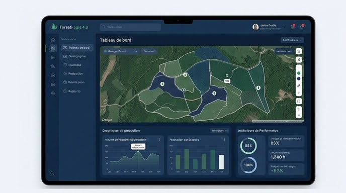
ForestLogix provides Ontario forestry operations with a centralized platform that connects every job site, crew and piece of equipment into a single coherent system. The platform handles multi-site management natively, allowing operations managers to oversee dozens of active blocks from a single dashboard. Production data, timesheets, fuel consumption, equipment maintenance and delivery information all flow into ForestLogix in real time as crews synchronize their field tablets.
MobileLogix, the field companion application, runs on rugged tablets designed for extreme conditions. It operates 100% offline -- a non-negotiable requirement for Ontario's vast, connectivity-poor territory -- and captures timesheets, production volumes, fuel logs, GPS tracks and georeferenced photos with just a few taps. When crews return to camp or pass through an area with cellular coverage, SyncLogix automatically pushes all collected data to the central ForestLogix server and pulls down any updated prescriptions or planning changes from the office.
GPS tracking under Ontario's dense boreal canopy
Reliable GPS tracking is fundamental to Ontario forestry operations, whether for delineating block boundaries, documenting road construction or tracking equipment movements. Ontario's boreal canopy, dominated by black spruce, jack pine and balsam fir, presents significant challenges for satellite signal reception. MobileLogix addresses this through support for external GNSS receivers via Bluetooth SPP, which access multiple satellite constellations (GPS, GLONASS, Galileo, BeiDou) to maintain accurate positioning even under dense canopy. Offline MbTiles maps and government WMTS layers ensure that operators always have context for their position, even without internet access.
Real-time sync between remote operations and head office
The gap between what is happening in the field and what the office knows is one of the costliest problems in Ontario forestry. With crews spread across hundreds of kilometres of forest, waiting days or weeks for paper-based reports to arrive at head office means managing operations with stale data. SyncLogix eliminates this gap. The moment a field tablet connects to Wi-Fi at a camp or hits a cellular signal along a highway, data flows both ways: production numbers, timesheets and GPS data go up to the server, while prescription updates, schedule changes and new instructions come down to the tablet. The office gains near-real-time visibility into every active operation.
Compatible with ArcGIS and QGIS through SIGLogix
Ontario forest engineers and planners rely heavily on GIS tools for forest management planning and spatial analysis. SIGLogix bridges the gap between field data collection and GIS workflows by enabling export to QGIS and ArcGIS in standard formats including Shapefile, GeoJSON and GeoPackage. GPS tracks, block boundaries and waypoints collected with MobileLogix integrate directly into existing GIS projects. This interoperability is bidirectional -- planners can prepare data layers in their GIS environment and push them to field tablets to guide daily operations.
Bilingual FR/EN interface for Northern Ontario
Northern Ontario has a significant francophone population, particularly in communities like Hearst, Kapuskasing, Timmins and Sudbury. Many forestry crews include both French and English speakers, and some contractors work on both sides of the Ontario-Quebec border. G.A. Logix solutions feature a fully bilingual French/English interface, allowing each user to work in their preferred language. This is not just a convenience -- it reduces training time, minimizes data entry errors and ensures that every crew member can use the software effectively regardless of their first language.
Request a free demo for your Ontario operation
Whether you are an SFL holder managing a large management unit, a harvesting contractor coordinating multiple crews or a silviculture company overseeing regeneration programs, G.A. Logix has the forestry software Ontario operations demand. Our solutions are proven across hundreds of deployments in Canadian boreal forest conditions, and our team understands the specific regulatory, logistical and environmental challenges of Ontario forestry.
Request a free demo tailored to your Ontario operation and discover how ForestLogix, MobileLogix and our complete suite of tools can modernize your data collection, streamline your reporting and give you real-time control over your entire operation.